
Veynes occupies a unique position in the Hautes-Alpes. Located in the middle valley of the Petit Buëch, between the Dévoluy massif and the foothills of Céüze, this municipality is both a historic railway junction and a gateway to an area that focuses on gentle travel.
Its inhabitants, the Veynois, live in a natural corridor oriented northeast/southwest that connects the Gap basin to the Buëch valley, and beyond to the Rhône valley via the Cabre pass.
Related reading : Portage salarial: a revolution in the world of freelance work
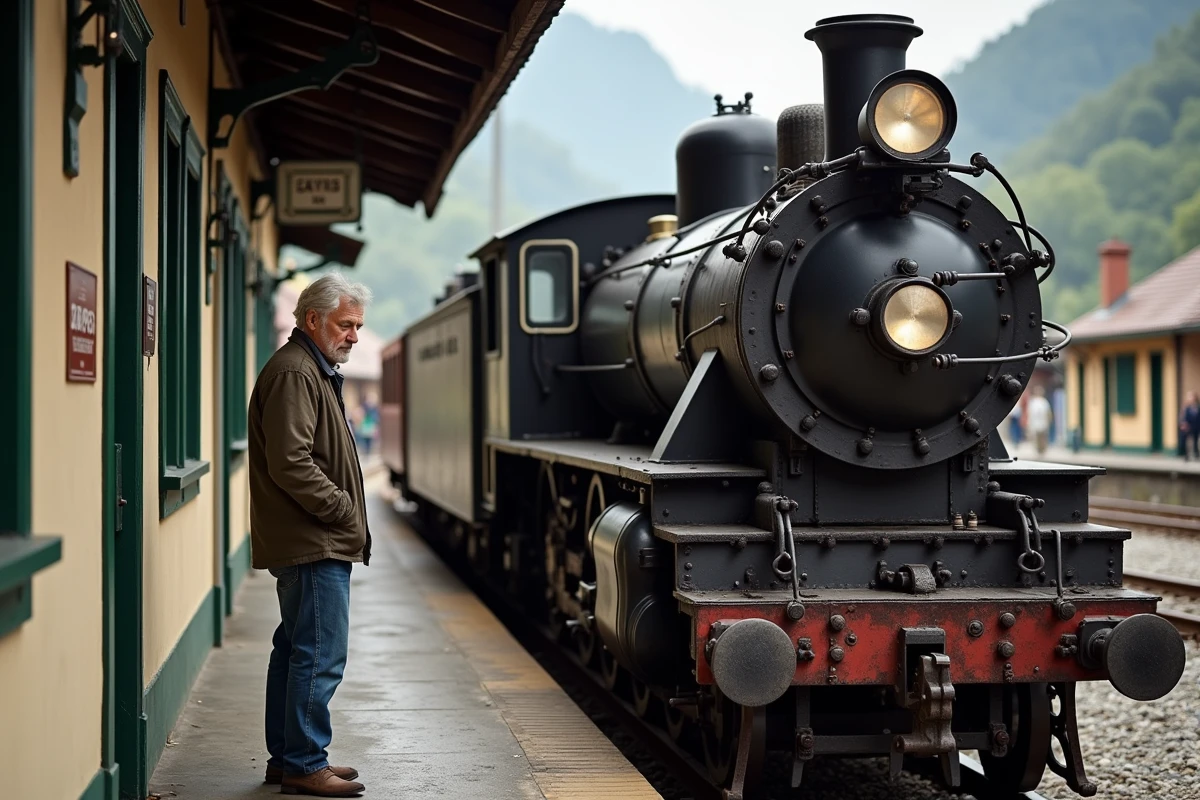
Veynes and the Alpine Line: An Active Railway Heritage
Most tourist presentations of Veynes mention its past as a “railway village” without going further. The reality is more complex. The Veynes-Dévoluy station remains a junction point between the Grenoble-Gap line and the Valence-Briançon line, making it a rare railway crossroads for a municipality of this size in a rural mountain area.
Since 2022-2023, SNCF Réseau and the Région Sud have initiated regeneration works on these lines: track renewal, modernization of signaling. The stated goal of the Région Sud in its document “Alpine Line: A Future for the Train” is to secure the sustainability of these rural services, often threatened by aging infrastructure. Municipal information published on ville-veynes.fr allows residents to follow local news related to these developments.
See also : The roller blind: ally of modern and functional decor
The Veynois Railway Eco-Museum reflects this identity. It is not just a simple object museum: the place documents how the railway has structured the economic and social life of the valley for over a century.
Slow Tourism in the Buëch: What the Tourism Restructuring Has Changed
The 2016-2019 territorial tourism reform integrated Veynes into the scope of the Buëch Sources Tourist Office, an intercommunal office that also covers Montmaur, La Roche-des-Arnauds, Le Saix, Furmeyer, Chabestan, Oze, and Saint-Auban-d’Oze. This grouping is not just administrative.
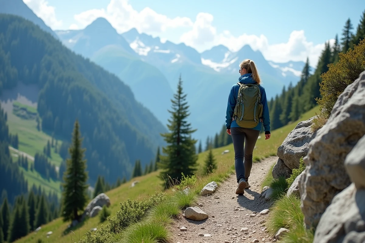
The strategy promoted by the Buëch-Dévoluy Community of Municipalities targets slow tourism and gentle travel: cycling, hiking, equestrian activities. The 2022-2027 tourism development plan of the intercommunal authority formalizes this direction. In practice, this translates into marked hiking loops, gravel circuits, and electric bike rental offers suitable for families.
Accessible Outdoor Activities Rather Than High Mountain
The Petit Buëch valley has a low average slope, making it accessible for less athletic audiences or families with children. Low elevation cycling and mountain biking routes have been labeled as part of the regional policy “Région Sud à vélo,” which has included the Buëch in its development axes.
The emphasis on accessible outdoor activities distinguishes Veynes from neighboring alpine resorts, which are more oriented towards demanding practices. The area does not seek to compete with the major resorts of Dévoluy in skiing or downhill mountain biking, but rather to attract an audience looking for less intense stays.
- Bicycle and gravel loops on low-traffic roads in the Buëch valley, with the possibility of renting electric bikes on-site
- Hiking trails connecting the surrounding hamlets (Oze, Furmeyer, Le Saix), accessible for much of the year thanks to the mid-mountain climate
- Supervised equestrian activities, integrated into the intercommunal gentle travel strategy
Built Heritage in Veynes: Church, Castle, and Medieval Traces
The village retains architectural elements that document several centuries of occupation. The parish church, visible from the valley, testifies to an ancient religious establishment. The streets of the old town maintain a readable medieval layout, with narrow passages and stone facades.
The Montmaur castle, located a few kilometers away, completes the heritage panorama of the area. This castle regularly hosts temporary exhibitions, such as one dedicated to the theme “You Will Cook in Pain,” scheduled as part of the cultural agenda of the Hautes-Alpes department.
The heritage of Veynes is reflected as much in the urban fabric as in the monuments. The morphology of the village, the relationship between the built environment and the course of the Petit Buëch, and the traces of agro-pastoral economy in the neighboring hamlets create a coherent whole, even if no major heritage protection distinguishes it on a national scale.
Geography and Natural Constraints of the Veynois Territory
Veynes is located in a valley corridor conducive to agriculture, but the geography imposes constraints that visitors rarely perceive. The Petit Buëch and its tributaries (Béoux, Drouzet, Glaisette) are all subject to torrential flow. Floods pose a recurring risk that has shaped the placement of buildings and local agricultural practices.
The valley separates the Dévoluy to the north from the Céüze, Aujour, and Saint-Genis massifs to the south. This configuration creates microclimates and varied landscapes over a short distance. The Céüze massif, with its characteristic limestone cliff, is visible from the village and serves as a significant landscape marker for the territory.
- Torrential flow of the Petit Buëch and its tributaries, with a flood risk that has historically constrained urbanization
- Northeast/southwest orientation of the valley, creating a natural circulation axis towards Gap on one side, and towards the Rhône valley on the other
- Proximity to the Dévoluy massif and the Céüze cliff, offering mid and high mountain landscapes accessible within minutes
For a stay in Veynes, the geographical configuration directs activities according to the seasons. The valley remains accessible in autumn and spring when the surrounding massifs are still snow-covered or difficult to access. This seasonal amplitude is one of the concrete assets of the territory for visitors who do not wish to depend on a narrow summer window.